|

Bangladesh's
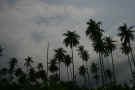
Geography
Covering
about 580 km of coastline along the Bay of Bengal is
Bangladesh. A low lying country, Bangladesh has
trouble with flooding. This is due to the number of
rivers in the country and the fact that most of the
habitable areas are found on a delta, one formed by the
Brahmaputra and Ganges rivers. The floodwaters bring
a lot of rich, alluvial soil with them and houses in this
area have to be built on platforms or high embankments.
These mud platforms and embankments are made from mud that
is taken out during the dryer months (those without
monsoons and the resulting flooding). The holes or
pits that are made by removing the mud are then filled
with water. This water is then used for drinking,
bathing and irrigation.
Only
a small portion of the country is considered hilly, the
southeastern section. In this area is found
Bangladesh's highest peak, Mowdok Mual (3,291 ft/1.003 m).
There are some insignificant hills found along the north
and eastern borders with India and there are two remnants
of alluvial terraces in the north central and northwestern
portions of Bangladesh. These are old terraces that
are not nearly as fertile as the floodplain surrounding
them. These terraces reach up to about 100 ft in
height (30 m).
|
Location:
|
|
Southern Asia,
bordering the Bay of Bengal, between Burma and
India
|
|
|
Geographic
coordinates:
|
|
24 00 N, 90 00
E
|
|
|
Map
references:
|
|
Asia
|
|
|
Area:
|
|
total: 143,998
sq km
country
comparison to the world: 94
land: 130,168
sq km
water: 13,830
sq km
|
|
|
Area -
comparative:
|
|
slightly
smaller than Iowa
|
|
|
Land
boundaries:
|
|
total: 4,246
km
border
countries: Burma
193 km, India 4,053 km
|
|
|
Coastline:
|
|
580 km
|
|
|
Maritime
claims:
|
|
territorial
sea: 12
nm
contiguous
zone: 18
nm
exclusive
economic zone: 200
nm
continental
shelf: up
to the outer limits of the continental margin
|
|
|
Climate:
|
| Current
Weather
tropical; mild
winter (October to March); hot, humid summer
(March to June); humid, warm rainy monsoon (June
to October)
|
|
|
Terrain:
|
|
mostly flat
alluvial plain; hilly in southeast
|
|
|
Elevation
extremes:
|
|
lowest point: Indian
Ocean 0 m
highest point: Keokradong
1,230 m
|
|
|
Natural
resources:
|
|
natural gas,
arable land, timber, coal
|
|
|
Land use:
|
|
arable land: 55.39%
permanent
crops: 3.08%
other: 41.53%
(2005)
|
|
|
Irrigated
land:
|
|
47,250 sq km
(2003)
|
|
|
Total
renewable water resources:
|
|
1,210.6 cu km
(1999)
|
|
|
Freshwater
withdrawal (domestic/industrial/agricultural):
|
|
total: 79.4
cu km/yr (3%/1%/96%)
per capita: 560
cu m/yr (2000)
|
|
|
Natural
hazards:
|
|
droughts;
cyclones; much of the country routinely inundated
during the summer monsoon season
|
|
|
Environment
- current issues:
|
|
many people are
landless and forced to live on and cultivate
flood-prone land; waterborne diseases prevalent in
surface water; water pollution, especially of
fishing areas, results from the use of commercial
pesticides; ground water contaminated by naturally
occurring arsenic; intermittent water shortages
because of falling water tables in the northern
and central parts of the country; soil degradation
and erosion; deforestation; severe overpopulation
|
|
|
Environment
- international agreements:
|
|
party to: Biodiversity,
Climate Change, Climate Change-Kyoto Protocol,
Desertification, Endangered Species, Environmental
Modification, Hazardous Wastes, Law of the Sea,
Ozone Layer Protection, Ship Pollution, Wetlands
signed, but not
ratified: none
of the selected agreements
|
|
|
Geography -
note:
|
|
most of the
country is situated on deltas of large rivers
flowing from the Himalayas: the Ganges unites with
the Jamuna (main channel of the Brahmaputra) and
later joins the Meghna to eventually empty into
the Bay of Bengal
|
|