|

Bhutan's
Geography
Bhutan's
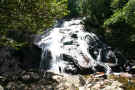
climate is as diverse as it's land. Depending on the
altitude, area and amount of sunlight, the climate can
range from bitter cold to a humid, hot tropical climate.
The precipitation that Bhutan gets comes between the
months of June to September and averages for the year
about 25 inches (650 mm).
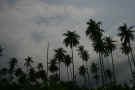
A
small country covering a little over 18,000 sq mi (47,000
sq km), Bhutan's land is very varied. Snow peaks in
the Himalayas, swamps and highlands are just some of the
land conditions that are found in a short range from each
other. The three main areas in Bhutan are the Great
Himalayan Region, Middle Himalayan Region and the Duars.
The
Duars, a plain only 5-8 miles wide (8-13 km), are located
along the Indian border and have a tropical climate.
The northern section of the Duars is home to wildlife such
as tigers and deer with its rugged, coarse terrain.
The southern portion of the Duars is cultivated for rice,
but had at one time been a jungle filled with bamboo.
The
Middle Himalayan region is part of the Himalayan range
that spreads down from the north and surrounds rich, broad
valleys. The valleys, with their mild climate are
cultivated and populated. The rainfall in this
region is average, not humid and wet like the Duars.
The
Great Himalayan Region borders Tibet and is relatively
uninhabitable. The highest peak in Bhutan is located
here, Kula Kangri (4,900-9,200 ft/1,500-2,800 m).
The high valleys are home to a few people, but the main
inhabitants in the bitterly cold climate are Bhutanese
yaks.
|
Location:
|
|
Southern Asia,
between China and India
|
|
|
Geographic
coordinates:
|
|
27 30 N, 90 30
E
|
|
|
Map
references:
|
|
Asia
|
|
|
Area:
|
|
total: 38,394
sq km
country
comparison to the world: 136
land: 38,394
sq km
water: 0
sq km
|
|
|
Area -
comparative:
|
|
about one-half
the size of Indiana
|
|
|
Land
boundaries:
|
|
total: 1,075
km
border
countries: China
470 km, India 605 km
|
|
|
Coastline:
|
|
0 km
(landlocked)
|
|
|
Maritime
claims:
|
|
none
(landlocked)
|
|
|
Climate:
|
| Current
Weather
varies;
tropical in southern plains; cool winters and hot
summers in central valleys; severe winters and
cool summers in Himalayas
|
|
|
Terrain:
|
|
mostly
mountainous with some fertile valleys and savanna
|
|
|
Elevation
extremes:
|
|
lowest point: Drangeme
Chhu 97 m
highest point: Gangkar
Puensum 7,570 m
|
|
|
timber,
hydropower, gypsum, calcium carbonate
|
|
|
Land use:
|
|
arable land: 2.3%
permanent
crops: 0.43%
other: 97.27%
(2005)
|
|
|
Irrigated
land:
|
|
400 sq km
(2003)
|
|
|
Total
renewable water resources:
|
|
95 cu km (1987)
|
|
|
Freshwater
withdrawal (domestic/industrial/agricultural):
|
|
total: 0.43
cu km/yr (5%/1%/94%)
per capita: 199
cu m/yr (2000)
|
|
|
Natural
hazards:
|
|
violent storms
from the Himalayas are the source of the country's
name, which translates as Land of the Thunder
Dragon; frequent landslides during the rainy
season
|
|
|
Environment
- current issues:
|
|
soil erosion;
limited access to potable water
|
|
|
Environment
- international agreements:
|
|
party to: Biodiversity,
Climate Change, Climate Change-Kyoto Protocol,
Desertification, Endangered Species, Hazardous
Wastes, Ozone Layer Protection
signed, but not
ratified: Law
of the Sea
|
|
|
Geography -
note:
|
|
landlocked;
strategic location between China and India;
controls several key Himalayan mountain passes
|
|