AsianInfo.org
supports
I.C.E.Y. - H.O.P.E. (non-profit
org) (International
Cooperation of Environmental Youth - Helping Our Polluted Earth)
Any advertisement you view helps save the environment!
Thanks!
A democratic republic located in the Western Pacific Ocean, the Republic of
the Philippines is made up of the Philippine Islands and is the island group at
the northernmost part of the Malay
Archipelago.
The Philippines is situated about 1,210 km (about 750 mi) east of the coast
of Vietnam and is separated in the north from Taiwan by the Bashi Channel.
Bounded on the east by the Philippine Sea (and Pacific Ocean), on the south by the Celebes Sea, and
on the west by the South China Sea, the archipelagic state comprises about 7,100
islands. Resulting from this situation are great variations in climate,
geography and vegetation.
The total area of the Philippines has a total area of about 300,000 sq km
(about 115, 830 sq mi). About 298,170 of the total area is land area with
the remaining 1,830 being the total water area. The capital and largest
city of the Philippines is Manila.
Extending 1,850 km (1,150 mi) from north to south and almost 1,127 km (700
mi) east to west, the Philippine Island group is of volcanic origin and
generally mountainous. Running parallel to the coasts, as well as
bordering them in many places, the mountain ranges extend north to south.
There are about 20 active volcanoes on the islands, and earthquakes are fairly
common.
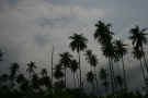
The larger islands, Luzon and Mindanao, are characterized by high mountains with alluvial plains
and narrow fertile valleys. Unlike the larger islands with their
relatively diverse topography, the smaller islands are mountainous with
surrounding flat lowlands.
Mount Apo, the Philippines' highest point, reaches 9692 ft (2954 m) and is
found in the southernmost ranges on Mindanao, the second largest Philippine
island.
Considered to be part of the Tropics, the Philippines' mean annual temperature is about 80°F (27°C) with the interior valleys
tending to be a little warmer and the mountain peaks a little cooler than the
mean. The relative humidity averages about 77%.
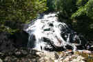
The rainy season is from May to November, which is the summer
monsoon, while the dry season occurs during the winter monsoon from December to
April. Typically, the weather is cool from November to February, while
it's very hot and dry from March to May. The rainiest times are from June
to October, with typhoons not uncommon during this time.
The average rainfall in the lowlands is about 80 inches a year (2030 mm).
Location:
Southeastern
Asia, archipelago between the Philippine Sea and
the South China Sea, east of Vietnam
Geographic
coordinates:
13 00 N, 122 00
E
Map
references:
Southeast Asia
Area:
total: 300,000
sq km
country
comparison to the world:72
land: 298,170
sq km
water: 1,830
sq km
Area -
comparative:
slightly larger
than Arizona
Land
boundaries:
0 km
Coastline:
36,289 km
Maritime
claims:
territorial
sea: irregular
polygon extending up to 100 nm from coastline as
defined by 1898 treaty; since late 1970s has also
claimed polygonal-shaped area in South China Sea
up to 285 nm in breadth
exclusive
economic zone: 200
nm
continental
shelf: to
depth of exploitation
Climate:
Current
Weather
tropical
marine; northeast monsoon (November to April);
southwest monsoon (May to October)
Terrain:
mostly
mountains with narrow to extensive coastal
lowlands
astride typhoon
belt, usually affected by 15 and struck by five to
six cyclonic storms per year; landslides; active
volcanoes; destructive earthquakes; tsunamis
volcanism: the
Philippines experience significant volcanic
activity; Taal (elev. 311 m, 1,020 ft), which has
shown recent unrest and may erupt in the near
future, has been deemed a "Decade
Volcano" by the International Association of
Volcanology and Chemistry of the Earth's Interior,
worthy of study due to its explosive history and
close proximity to human populations; Mayon (elev.
2,462 m, 8,077 ft), the country's most active
volcano, erupted in 2009 forcing over 33,000 to be
evacuated; other historically active volcanoes
include Biliran, Babuyan Claro, Bulusan, Camiguin,
Camiguin de Babuyanes, Didicas, Iraya, Jolo,
Kanlaon, Makaturing, Musuan, Parker, Pinatubo and
Ragang
Environment
- current issues:
uncontrolled
deforestation especially in watershed areas; soil
erosion; air and water pollution in major urban
centers; coral reef degradation; increasing
pollution of coastal mangrove swamps that are
important fish breeding grounds
Environment
- international agreements:
party to: Biodiversity,
Climate Change, Climate Change-Kyoto Protocol,
Desertification, Endangered Species, Hazardous
Wastes, Law of the Sea, Marine Dumping, Ozone
Layer Protection, Ship Pollution, Tropical Timber
83, Tropical Timber 94, Wetlands, Whaling
signed, but not
ratified: Air
Pollution-Persistent Organic Pollutants
Geography -
note:
the Philippine
archipelago is made up of 7,107 islands; favorably
located in relation to many of Southeast Asia's
main water bodies: the South China Sea, Philippine
Sea, Sulu Sea, Celebes Sea, and Luzon Strait
AsianInfo.org
supports I.C.E.Y. -
H.O.P.E. (non-profit org) (International
Cooperation of Environmental Youth - Helping Our Polluted
Earth) Any advertisement you view helps save the
environment! Thanks!
Disclaimer:
AsianInfo.org
does not guarantee the complete accuracy of the information provided on
this site or links. Do your own research and get a professional's
opinion before adhering to advice or information contained herein.
Use of the information contained herein provided by AsianInfo.org and
any mistakes contained within are at the individual risk of the user.
(We
do not provide links to, or knowingly promote, any violent or pornographic
sites.)